

One of the most common questions we get at ParentShield is “How can I locate my Child’s phone?” It’s one of the most useful features of a modern mobile phone, and something that we’ve got used to being there, but does it always work? and How does it work? What hardware do I need, and what can go wrong? We thought we’d ask our Network Specialist to put a page together with everything you need to know, and certainly expose one or two things you probably didn’t!
How does Geolocation work?
There are actually 4 main methods of mobile phone geolocation:
- Satellite Positioning using a Global Navigation Satellite System ( GNSS )
- Network Geolocation – finding a location based on the IP address the phone has acquired
- Radio Positioning – using data from the phone’s WiFi and Bluetooth radios to pinpoint known locations in the vacinity
- Cell Tower Triangulation – AKA GSM Location
Each of these has its own set of quirks, requirements, accuracies and inaccuracies that, once understood, allow us to make a bit more sense of the, sometimes erratic behaviour of any location method. All modern mobile phones can use all four of the above in a single location activity! The location you see on a map is a ‘mash up’ in many cases drawn from all of the above.
Don’t be fooled by pretty maps!
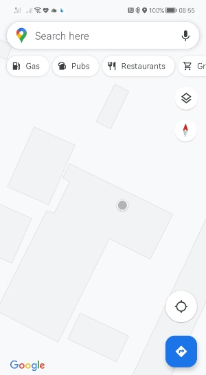
It’s easy to become convinced of a location when your computer presents a compelling and precise-looking location with that little location dot looking exactly as if it knows what it’s doing!
In reality – this is a pictorial overlay of the system’s “best guess” on top of a map. It may be accurate, but it may not and it has to be taken with a pinch of understanding from time to time.
Here I am, according to my Phone, sat watching TV in my neighbour’s living room. But I’m not.
We had one customer organise a dive-team to retrieve a phone from a river, when it was actually safely in a school bag in the bedroom.
Satellite Location via a GNSS
Most of us say “GPS” for Global Positioning System but GPS actually refers to the USA’s network of satellites. It’s just one of the available networks of satellites that your child’s mobile phone can likely ‘see’.
How a GNSS works
A satellite navigation system works by a ‘constellation’ of satellites that orbit the Earth, each transmitting on a known frequency, their identity and a *very* accurate time signal courtesy of their onboard atomic clocks. By picking up signals from more than one satellite, it’s possible to decode their orbits, and the time taken for their signals to reach a child’s mobile phone, to piece together a likely location and a ‘confidence rating’. In ideal clear-skies situations it is possible to get a location from the open satellite networks down to an accuracy of 1 metre, or 3 feet when locating grandchildren. The satellites also transmit an encrypted high-resolution version for military use that’s accurate down to 1cm!
These satellite constellations are operated and controlled by nation states that have the ability to turn the signals on or off, and provide varying degrees of accuracy for civilian or military use. Understandably, Russia, USA, Europe, China and India all have their own systems as they won’t want to have to rely on a system they can’t control. All of these separate systems provide data that can be part of a single location activity.
At the time of writing my mobile phone can see 31 satellites, 10 of which are providing useful location data. On its own, the data is pretty useless and needs to be matched against the databases provided by the control segment of each of the controlling networks. These databases need to be constantly updated with orbit and timing information, and the satellites’ clocks need to be tweaked to account for their speed and orbit. This means that any real-time child location effort will require their mobile phone to be turned on, and connected to the internet, so the resulting data can be extracted and processed by a remote system. The phone itself doesn’t actually know where it is – it has to send all this interesting data off to a mobile service ( Apple, Google, or Huawei usually ) to have the information decoded.
Satellite signal reception will depend on weather conditions, local interference, and access to the sky. Being inside buildings, tunnels, or the shadow of natural or man-made objects such as buildings, mountains etc.
The GNSS networks
- GPS – The American GPS system was the first GNSS available. GPS has currently 24 Satellites in medium Earth Orbit ( about 20,000km high ) and these circle the Earth twice a day each. It was the first GNSS and was started in the 70’s. It has a slightly lower accuracy than the newer networks.
- GALILEO – This is the European GNSS that went live in 2016 so some older mobile phones may not see it. It has 22 ( currently ) active satellites and a 1m accuracy. Galileo satellites are around 23,000km orbit and a different frequency to GPS.
- GLONASS – Glonass is the Russian GNSS and has 24 satellites in a slightly different orbit to the GPS satellites allowing it to provide slightly better coverage in higher latitudes.
- BeiDou – BeiDou is the Chinese GNSS. It used to be known as COMPASS. There are 35 operational BeiDou satellites that are actually 3 separate networks that have been expanded over time. Originally it was covering just the Chinese mainland area but the newer BeiDou-3 satellites are providing worldwide coverage in competition with GPS, Galileo and Glonass
To do any Satellite location you will need phone hardware that includes a satellite receiver, and make sure it is connected to the internet. If it’s a ParentShield SIM – head over to the Mobile Data Setup Guide and make sure the phone is ready for data, and that data is turned on, and location services are turned on, on the phone and that they have the necessary permissions for internet access. This will then allow you to use your phone provider’s location service – Find My iPhone, Google Location Service, or Huawei Cloud as necessary.
You will also need the phone to be properly set up with its own unique ID. We often see phones handed down to children without being properly set-up as a new device. Unfortunately this means it’s sometimes difficult to do the things you need to do.
If you are setting up a child’s phone for location purposes – there is a list of things to do on our Locating a Child’s phone help page.
Radio Location via WiFi or Bluetooth
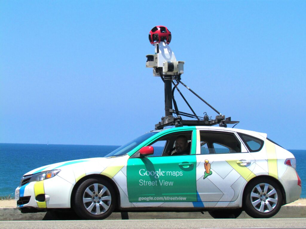
The Google Street-View cars, and other sources, constantly gather radio information – such as the identity of your home WiFi router – and tag that in huge databases with the location that it was seen at.
This means that a child’s mobile phone can report back to base with scans of all the wifi signals around it and this can be used to provide a very accurate idea of location. It’s not necessary to be ‘paired’ with those WiFi stations or BlueTooth beacons to see their Identity and the distance you are from them. This information can be compared against Google or other open-source databases and turned back into a location.
Unfortunately it’s not unknown for these big databases to hold out-of date information. I took an old Wifi Router from home to the ParentShield offices to use for staff WiFi in our luxurious canteen* and more than one of the staff reported seeing their location ‘jump’ 10 miles to the east.
Location of a Child by Cell-Tower Triangulation
Every time a mobile phone moves into the range of a new cell tower, or every time it’s turned on, or when it’s reestablishing connection after a period of disconnection, it communicates with the network operating that cell tower and passes over it’s IMSI – that’s the SIM card’s unique ID number and this is stored in the mobile network’s “HLR” database along with the identity of the network, the cell tower ID, network code Country code and Location ID.
The Cell Tower ID’s are all available in several databases and it’s possible – in most cases to look up the location of the cell towers that the phone has seen and pinpoint a, sort of, location for the phone. Now you’ve seen this done on TV police dramas. That’s mostly fiction. It depends on the location and density of cell towers but in many cases you will be able to locate the phone to within a few miles at best. I’ve just looked up my phone and I can pinpoint me to somewhere between Derby and Ashbourne. If anyone can locate me or my phone from that information, good luck!
Whenever there is an urgent situation, the police will request the digest of connection information from us – and that will potentially form a pattern of movement – did this child get on a train, travel from London to Manchester etc. Unfortunately the information is not refined enough to pinpoint anything other than a very broad area. For this reason we don’t include this information in the Portal as the inaccuracy can be distressing taken out of context.
What it can do though, is provide a starting point. You will often see when you locate a phone the location accuracy, the confidence rating, increase after a few seconds. This is done by taking at the last known location information and using it to prime other searches.
*not luxurious